Travel Information
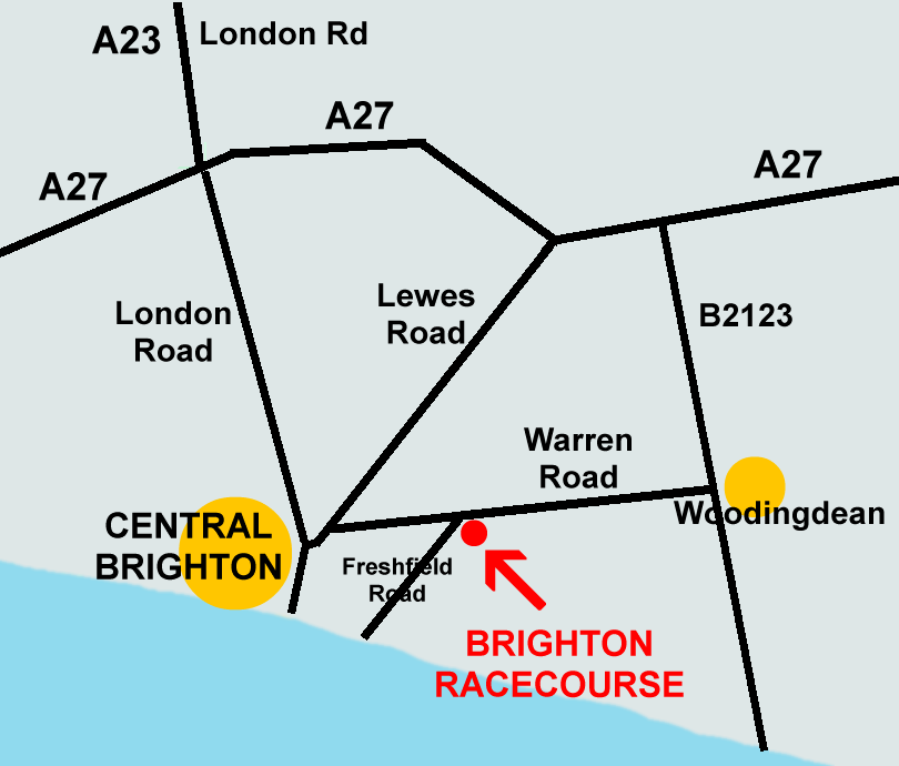
Brighton Racecourse (BN2 9XZ) is about 2 miles north-east of Brighton city centre. It's just 10 mins drive from the A27 and about 10 mins drive from the beach. There's a regular bus route from Brighton city centre and a bus stop a few mins walk from our event.
If you're coming by car, there's free parking for hundreds of cars just next to the entrance to our show and marshals will be there to show you where to park.
Travelling by Road
Please use BN2 9XZ in your Sat Nav or Google maps. If you're approaching Brighton along the A23 (London Road), the best route to take is east on the A27. Head for signs directing you to Sussex University and take the B2123 to Woodingdean. At Woodingdean, turn right at the traffic lights onto Warren Road, and the racecourse is approximately one mile on your left-hand side.
You can also reach the racecourse via the city centre although there's likely to be more congestion using that route.
If you're coming from the seafront, head for the Brighton Palace Pier before driving eastbound along Marine Parade. Turn left at the first set of lights onto Lower Rock Gardens. Turn right at the second set of lights onto Edward Street, then first left onto Freshfield Road. The Racecourse is at the top of the hill.
Car parking at Brighton Racecourse is free.
Travelling by Public Transport
The No. 2 and No. 22 bus routes run from the city centre (outside the Churchill Shopping Centre at Stop H) to the racecourse. There are 2 bus stops very near the racecourse which are called Pankhurst Avenue and Race Hill. The Churchill Square Shopping Centre is a 10-minute walk from Brighton Railway Station.
A taxi journey from the city centre should take less than 10 minutes, and costs around £7 - £12.